


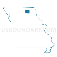
Novinger Voting District, Adair County, Missouri
About
Outline

Summary
| Unique Area Identifier | 607000 |
| Name | Novinger Voting District |
| County | Adair County |
| State | Missouri |
| Area (square miles) | 212.97 |
| Land Area (square miles) | 212.81 |
| Water Area (square miles) | 0.16 |
| % of Land Area | 99.93 |
| % of Water Area | 0.07 |
| Latitude of the Internal Point | 40.20416020 |
| Longtitude of the Internal Point | -92.77083690 |
Maps


Graphs
Select a template below for downloading or customizing gragh for Novinger Voting District, Adair County, Missouri


Neighbors
Neighoring Voting District (by Name) Neighboring Voting District on the Map
- Elm Voting District, Putnam County, MO
- Ethel Voting District, Macon County, MO
- Green Castle Voting District, Sullivan County, MO
- Greentop Voting District, Schuyler County, MO
- LaPlata Voting District, Macon County, MO
- Mystic Voting District, Sullivan County, MO
- North Salem Voting District, Linn County, MO
- Pennville Voting District, Sullivan County, MO
- Rural Benton Voting District, Adair County, MO
- Winigan Voting District, Sullivan County, MO
Top 10 Neighboring County Subdivision (by Population) Neighboring County Subdivision on the Map
- Benton township, Adair County, MO (19,700)
- Nineveh township, Adair County, MO (1,289)
- Penn township, Sullivan County, MO (1,208)
- Pettis township, Adair County, MO (795)
- Salt River township, Schuyler County, MO (728)
- Polk township, Adair County, MO (639)
- Elm township, Putnam County, MO (579)
- Morrow township, Adair County, MO (431)
- Liberty township, Adair County, MO (324)
- Walnut township, Adair County, MO (257)
Top 10 Neighboring Place (by Population) Neighboring Place on the Map
Top 10 Neighboring Unified School District (by Population) Neighboring Unified School District on the Map
- Kirksville R-III School District, MO (22,063)
- Putnam County R-I School District, MO (4,843)
- Schuyler County R-I School District, MO (4,565)
- La Plata R-II School District, MO (2,731)
- Adair County R-I School District, MO (1,872)
- Green City R-I School District, MO (1,731)
- Bucklin R-II School District, MO (1,066)
- Macon County R-IV School District, MO (859)
Top 10 Neighboring State Legislative District Lower Chamber (by Population) Neighboring State Legislative District Lower Chamber on the Map
- State House District 3, MO (35,529)
- State House District 2, MO (35,389)
- State House District 1, MO (33,818)
- State House District 8, MO (33,540)
Top 10 Neighboring State Legislative District Upper Chamber (by Population) Neighboring State Legislative District Upper Chamber on the Map
- State Senate District 12, MO (169,332)
- State Senate District 21, MO (163,305)
- State Senate District 18, MO (159,547)
Top 10 Neighboring 111th Congressional District (by Population) Neighboring 111th Congressional District on the Map
Top 10 Neighboring Census Tract (by Population) Neighboring Census Tract on the Map
- Census Tract 9505, Adair County, MO (7,079)
- Census Tract 9501, Adair County, MO (3,802)
- Census Tract 9502, Adair County, MO (3,019)
- Census Tract 9503, Adair County, MO (2,951)
- Census Tract 9601, Putnam County, MO (2,725)
- Census Tract 9602, Macon County, MO (2,719)
- Census Tract 4702, Schuyler County, MO (2,356)
- Census Tract 4801, Sullivan County, MO (2,124)
- Census Tract 4901, Linn County, MO (1,741)
Top 10 Neighboring 5-Digit ZIP Code Tabulation Area (by Population) Neighboring 5-Digit ZIP Code Tabulation Area on the Map
- 63501, MO (21,532)
- 63565, MO (3,805)
- 63546, MO (1,715)
- 63559, MO (1,420)
- 63544, MO (818)
- 63557, MO (291)
- 63538, MO (283)
- 63566, MO (125)